|
Forest Park Map.com
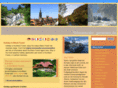
Maps of Forest Park, Portland, Oregon, 2008. Limited edition, highly detailed wall maps of Forest Park are available. Ideal for framing, laminating or just pinned to your wall. Printed on acid and lignen free 100% cotton paper, using twelve colors of archival inks, these maps are "the most detailed to date" says designer CJ DeWaal. A version of this map is included on new trailhead signs to be installed in Fall of 2008 at various Forest Park entrances. A portion of the proceeds for each map sold will be donated to the Forest Park Conservancy, formerly Friends of Forest Park.
Alder, Aspen Ave, Aspen, Barnes, Birch, Birch, BPA, Burnside, Cannon, Chestnut, Collins Sanctuary, Cornell, Dogwood, Firelane, Germantown, Hardesty, Holman, Hoyt Arboretum, Japanese Garden, Leif Erikson Drive, Linnton, Lovejoy, Lower Macleay, Maple, Nature, Newberry, Newton, Nw 23rd, Oregon Zoo, Pittock, Pittock Mansion, Ridge, Rose Garden, Saltzman, Skyline Blvd, Springville, St. Helens, St. Johns Bridge, The Audubon Society Of Portland, Thompson, Thurman,illium, Tunnel, Upper Macleay, Upshur, US 26, Vista, Washington Park, Water Line, Willalatin, Wild Cherry, Wildwoodail, Willamette River, World Forestry Center, Yeon, 53rd
Forestparkmap.com ~
Site Info
Whois
Trace Route
RBL Check
|