 |
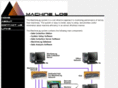
MAAD2GO - maad2go : Geographical Information System GIS Database and Document Control
MMAD2GO, The clever way to geographically organise & retrieve your data â Spatial or Textual.
MAAD2GO provides the functionality for organisations to build and manage centralised geographical locatable libraries of their data (both spatial from their GIS or textual*) in order to make it easy for all who need the data to find it, understand it and use it.
MAAD2GO creates libraries of data by tying files to their geographical locations, either internally defined from within the files (such as industry GIS formats like MapInfo .tab or ESRI .shp) or for non-spatial files (textual) which are defined and associated by you. You can associate non spatial data to a location by either defining the location via the in-built map render engine, defined project areas, bookmarked areas or through customised GIS data settings.
Compiled entirely within the .NET framework and operates as a stand alone desktop application, MAAD2GO is not dependent on any other programs to operate.
MAAD2GO uses the latest .NET technologies to provide an efficient and an intuitive interface that is easy to understand and use. This allows non-administrative or non-technical people the ability to install the application and get up and running quickly and easily (with little or no training), making MAAD2GO suitable for a wide variety of potential users.
As MAAD2GO is an âalways on topâ application, it integrates well with other products, including MapInfo Professional. Additional functionality is provided to MapInfo Professional users in the way of additional compiled routines that operate within the MapInfo environment, and comes free with all MAAD2GO installations.
* Spatial data formats â MapInfo .TAB, ESRI Shapefiles (.shp) Textual file formats â e.g. such as Microsoft Office Suite (.doc, .docx, .xls, .pptx, etc), Adobe PDF, or any image formats.
Maad2go.com ~
Site Info
Whois
Trace Route
RBL Check
|
|
|
|