Towns: 25,542 results found.
 |
PixelMapUk Britain 21:24, 15th April
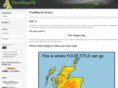
Mick Forster's pixel map of the UK. The map image is a jpeg compressed bitmap of 700x1102 pixels. Each pixel therefore represents 1 sq km on the ground. The bottom left hand corner is equivalent to the OSGB false origin of the National Grid. On this web-site there are also UK outline maps in PDF format suitable for educational geography class, Maps of Great Britain with various amount of detail.The maps include the coastline of England Scotland and Wales as well as the Channel Islands.
Pixelmapuk.co.uk ~
Site Info
Whois
Trace Route
RBL Check
|
|
|
|